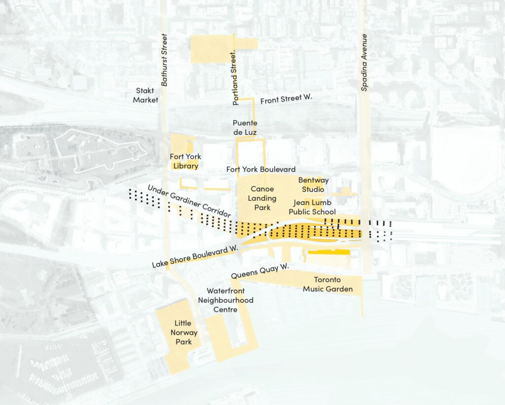
Under Gardiner Islands
Fort York Blvd to Spadina
Bents 96-132
As the name suggests, this district contains a series of disconnected Under Gardiner spaces that are either privately owned public spaces (POPS) or under City jurisdiction. Strengthened connections, expanded park networks, and new amenities for retail and recreation will further enhance the public realm to better serve the surrounding vertical neighbourhoods.
The Possibility
Strengthened connections, expanded park networks, and new amenities for retail and recreation could further enhance the public realm and better serve the surrounding vertical neighbourhoods By expanding the existing Canoe Landing Park into Under Gardiner space, the Public Realm Plan recommends additional opportunities for retail, recreation, and cultural programming.
Key Insights from the Outreach Process
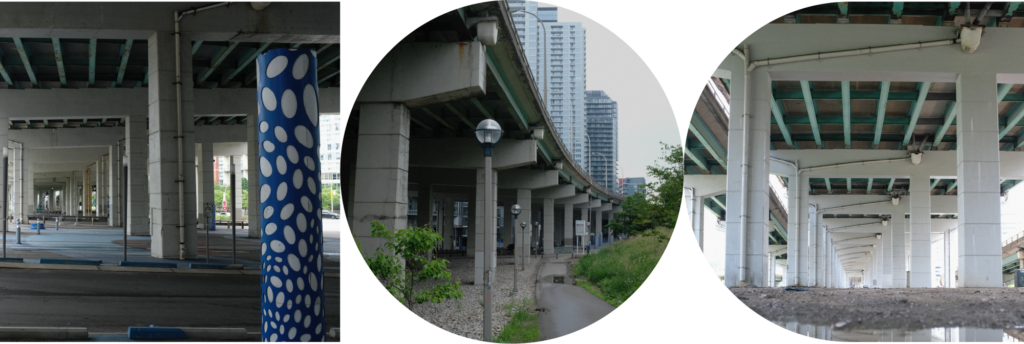
The large under-used medians which characterize the Under Gardiner Island district are latent opportunities to create new destinations. However, in their current state, they remain inaccessible and even dangerous; vehicles on Lake Shore Boulevard often travel at high speed. Traffic calming and generally reducing car speeds were identified as key means for improving safety, access, and connectivity.
Participants said they like:
- Green space with native plant species along the south side of the rail corridor between Spadina and Dan Leckie Way.
- Public art, murals, and Indigenous art.
- Widespread support for more public spaces and landscaped areas, such as the planned Lower Garrison Creek Park.
- Connected bike lanes, and would like to see the network expanded.
Participants said they dislike:
- Areas under the Gardiner in this district are dirty (with litter and bird droppings) and left flooded or muddy after the rain.
- Areas that seem unsupportive of public spaces and connected pathways. For example, there are no sidewalks on Housey Street.
- Long wait times and dangerous pedestrian crossings.
- Construction barriers and unprogrammed spaces that act as barriers to pedestrians
Ideas and suggestions shared by participants:
- Mitigate traffic noise near residences.
- Add outdoor cultural events and/or community spaces that could accommodate food trucks, live music, and other events.
- Improve the sidewalks and pedestrian priority spaces.
- Add an eastbound ramp down from the rail corridor pedestrian bridge.
Emerging Opportunities
PLEASE NOTE: The ideas represented in the diagram presented are subject to further study
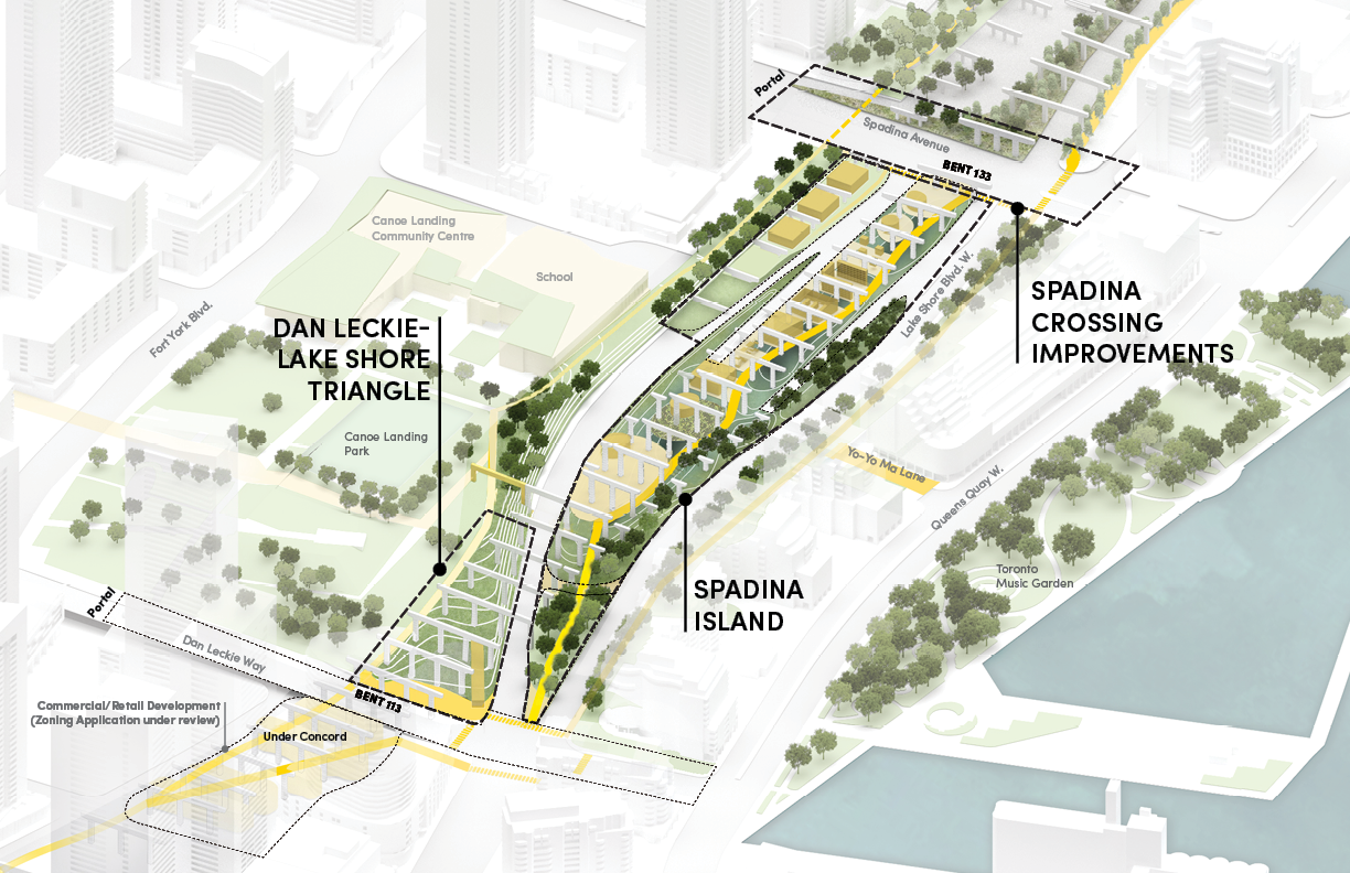
Dan Leckie-Lake Shore Triangle
The Dan Leckie-Lake Shore Triangle (LLT) is at the doorstep of numerous downtown neighborhoods, including City Place/Fort York, Bathurst Quay, Little Norway, and the Waterfront.
The site is earmarked for an essential park expansion that will bring new and enhanced amenities to the area including off-leash areas, multi-use trails, cultural programming, and blue-green infrastructure.
Spadina Island
Spadina Island is a large transportation median bounded by Lake Shore Boulevard on the north, south, and west, and by Spadina Avenue on the east. Flanked by on- and off- ramps offering vehicular access from Lake Shore Boulevard to the Gardiner Expressway, the site is exposed to traffic noise and visual clutter.
The design for Spadina Island should be developed in concert with that of the Dan Leckie-Lake Shore Triangle and provide multiple access points as part of a holistic approach to district connectivity.
The Spadina Island should be designed to support the extension of an Under Gardiner multi-use trail as well as performative landscapes, biodiversity, and traffic buffers/screens on the active edges. Maintenance and storage that will support ongoing site operations can be sited to the northeast corner, taking advantage of the grade change and resulting street wall.
Spadina Crossing Improvements
Southern Linear Park is an existing trail that runs from Dan Leckie Way to Bremner Blvd and is interrupted by Spadina Avenue.
In order to ensure safety, accessibility, and connectivity, the intersection must be regularized to allow an at-grade crossing north of the Spadina/Lake Shore intersection, connecting the two sides of Southern Linear Park. Further studies are recommended to explore approaches and implementation.